 Website:
WOOBOAT
Catalog excerpts

KETEATECH Maritime Area Integral Supervision (MAIS) & Vertical Solutions (VS) Powered by
Open the catalog to page 1
The PaaS MAIS Suite The PaaS MAIS Suite are integrated systems of hardware (Wooboat devices) and software platforms (PaaS MAIS) whose purpose is to control and collect data from a maritime area with a defined perimeter called Integrated Maritime Area Integral Supervision (MAIS) It basically consists of the following systems: 1. PaaS MAIS (GSM & Satellite) System 2. PaaS MAIS (GSM & Satellite) Data Reporting 3. MAIS Customer Expert Report PaaS MAIS (GSM & Satellite) System PaaS MAIS (GSM & Satellite) Data Reporting The PaaS MAIS System also provides Vertical Solutions to solve specific...
Open the catalog to page 2
1-Define the Perimeter (where) A MAIS is defined by a Perimeter, a vector layer, in which everything can be monitored. ❖ Fishing fleet control ❖ Nature Reserve ❖ Wind Farm ❖ Port Authorities ❖ Conflit zones ❖ Area of Special Interest (ASI) The MAIS perimeter defines the controls according to the device embedded . ❖ Wooboat - Ketea Device in Boats ❖ AIS Stations in vessel and land. ❖ Wooboat - Ketea App ❖ CCTV System ❖ Directional radars ❖ Oil Spill & Risk evaluation ❖ CO2 Emissions & EEOI 3-Define how to Display With the data collected from the perimeter, the system performs the necessary...
Open the catalog to page 3
The Perimeter A MAIS (Maritime Area Integral Supervision) is defined by a perimeter, a Vector Layer designed like an irregular Polygon (GIS), in which everything can be controlled. The information received from the polygon are multiple but the main ones are the geolocalization of the perimeter itself with its areas of interest and those generated by the boats equipped with our device and others external suppliers. The other data usually collected inside the polygon are from vessels equipped with an AIS, or those who use our geolocation application on their mobile phones, but many others can...
Open the catalog to page 4
The Control The information pushed by a fleet are the master data from which report, KPI, … will be calculated. The first controls for each boat are routes, navigation times, courses, miles traveled, consumptions and CO2 emissions as well as the calculation of the operational energy efficiency indicator (EEOI). Each of them is stored, evaluated and studied to be improved and optimized. Entrances and exits as well as distances and times travelled in the ASI (area of special interest) can be precisely controlled. In a second step, we look for correlations or simple relationships between boats...
Open the catalog to page 5
❖ AIS Control module incorporating AI, to upload the data into the platform and servers ❖ Control of gas consumption and emissions module according to EMEP/EEA Report |No 13/2019. ❖ Control Contamination module for monitoring of Oil Spill + Plastics ❖ Posidonia Satellite Control Module ❖ Satellite Spill Control Module ceorence Areas control nistory -Member of- WORLD ALLIANCE byS0LARIMPULSE for EFFICIENT SOLUTIONS | FOUNDATION
Open the catalog to page 6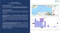
The Visualization (The Intelligent Data Analysis & Report) Dynamic Data in Server The Data generated by the boat is stored on secured servers with dynamic access through the PaaS MAIS (GSM & Satellite) System. Historic Data download All data are available to download in raw format. Specific software can provide analysis, using GIS, Machine Learning and advanced statics technologies. Customized Reports in PaaS MAIS (GSM & Satellite) Data Reporting allow to personalized of the data display (data visualization) with highly customized prediction maps and advanced analysis, useful to know for...
Open the catalog to page 7
-Member of-- WORLD ALLIANCE bySOLARIMPULSE for EFFICIENT SOLUTIONS | FOUNDATION MAIS Maritime Area Integral Supervision MARKETS Groundfish in the sea Ports Authorities
Open the catalog to page 8
Vertical Solutions What is it?
Open the catalog to page 9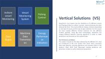
Inshore vessel Monitoring Data Buyos Vessel Monitoring System Maritime Data Transmissi on Fishing Control Energy Performan ce Indicators Vertical Solutions (VS) KeteaTech’s Core System has the flexibility to fit different vessels and floating artifacts to collect, transmit, store and process the data obtained by them. This means different display solutions depending on the type of vessel and the type of data collected. For this reason we have created different Vertical Solutions for the different markets possible. Using Big Data technologies, KeteaTech has created different Machine Learning...
Open the catalog to page 10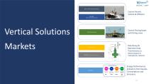
Control Vessels Inshore & Offshore Vertical Solutions Markets Control Fishing boats and fishing areas Data Buoys & Maritime Data Trasmissions (as Meteorological or Hydrophones stations) Energy Performances Indicators from Vessels. Consumptions and Emissions. 11
Open the catalog to page 11
Wooboat Switzerland (Headquarters) Nicolas Vandeweghe Rue des Bains, 35 1205 Geneva, Switzerland +41 76 326 25 41 +33 609 95 25 41 skypeID: wooboat nicolas.vandeweghe@wooboat.com nicolas.vandeweghe@keteatech.com Keteatech powered by Wooboat Spain Gonzalo Portas Emilio Gonzalez Ctra. Valldemossa km 7.5, Ed. Disset 1a Pta 07121 Palma de Mallorca (Baleares) Parque Balear de Innovacion Tecnologica +34 622 50 13 95 +34 608 13 24 77 gonzalo.portas@keteatech.com Wooboat Malta Russlan Cilia Salini 5, Triq Lifurna Marsalforn, Goto Malta +356 79788276 +356 27554649 russlan@hydrorg.com WORLD ALLIANCE...
Open the catalog to page 12All WOOBOAT catalogs and brochures
-
Brochure
4 Pages


