Catalog excerpts

PRODUCT SHEET VERIPOS ViNE SOFTWARE VISUALISATION SOFTWARE ViNE GNSS visualisation software provides clear, well-defined 2D and 3D imagery to support the precise positioning requirements of Dynamic Positioning Operators (DPOs) and marine crew. ViNE displays key positioning information and statistics that allow operators to make speedy, informed decisions aboard vessels. Integrating essential views such as GNSS plots of all available constellations and correction delivery satellites, the displays also include plots of position calculations. Vivid traffic light indicators show overall system health. The above image displays 3D navigation display and position status information. ViNE is designed to run independently from the position calculation, allowing users to interact freely with the software without impacting the position feed to the DP system. ViNE provides the operator with a position monitoring system which can be used in DP drilling operations and FPSO monitoring applications. The above image shows 2D navigation display and information on a VERIPOS service.
Open the catalog to page 1
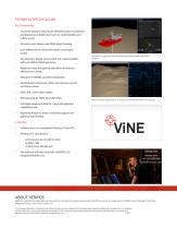
TECHNICAL SPECIFICATIONS Key Functionality • 2D and 3D graphics allowing for detailed project visualisation and displaying multiple layers such as seabed profiles and subsea assets; Accurate vessel shapes and offset/target tracking; User defined watch circles with alarms and escape routes; The polar plot display shows GNSS and L-band satellites with user defined blockage zones; Waypoint range and bearing calculation to selected offsets on the vessel; GNSS Dilution of Precision (DOP) plot showing current and future values; GNSS and L-Band status tables; SNR reporting for GNSS and L-Band SVs;...
Open the catalog to page 2All Veripos catalogs and brochures
-
V560™ Marine Antenna
2 Pages
-
GAJT-710MS
2 Pages
-
LD6 Integrated Mobile Unit
2 Pages
-
LD5 Integrated Mobile Unit
2 Pages
-
LD8™ Receiver
2 Pages


