


Platinum Catalogue

Platinum Catalogue
Navionics is a company with multiple international offices, including locations in Italy, the USA, the UK, and Australia. They provide contact information for each office, including phone numbers and email addresses.
Navionics offers electronic charts designed to aid navigation. These charts are intended to complement, not replace, official government charts. The company emphasizes the importance of using official charts for safe navigation.
Navionics Platinum charts offer multi-dimensional features such as 3D views, satellite photo overlays, panoramic pictures, and dynamic tides and currents. They also include port services and points of interest, coast pilot books, and all features of Gold Charts, such as shaded depth contours and detailed port plans.
The document lists various coverage areas for Navionics charts, including regions in Europe and Oceania. Specific areas covered include Norway, Sweden, Finland, the Baltic Sea, the UK, Ireland, the Mediterranean, the Black Sea, Australia, and New Zealand.
Navionics charts are compatible with various chart plotters, including models from Geonav, Northstar, Raymarine, Humminbird, and Lowrance. The document advises users to ensure their operating systems are up-to-date and to consult dealers or the Navionics website for a complete list of compatible plotters.
The product is partially produced with agreements from various hydrographic offices and organizations. However, these offices do not verify the product and do not accept liability for its accuracy. The document also includes copyright information and acknowledges contributions from various sources.
Catalog excerpts
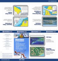
www.navionics.com N a v i o n i c s P l a t i n u m | M u l t i - D i m e n s i o n a l C h a r t s ©2008 Navionics Spa, Italy BRO/PT/EN/0208 Authorized Dealer for Serious Navigation • 3D View • Satellite Photo Overlay • Panoramic Pictures • Port Services & Points of Interest • Dynamic Tides & Currents • Coast Pilot Books WARNING: The electronic chart is an aid to navigation designed to facilitate the use of authorized government charts, not to replace them. Only official government charts and notices to mariners contain all the information needed for safe navigation, and as always, the captain is responsible for their prudent use. ACKNOWLEDGMENT: This product is produced, in part, from the products and with the agreement of Imray (UK) and the hydrographic offices of Australia, Denmark (KMS), Finland (FMA), France (SHOM), Greece, Italy, Norway, South Africa, the United Kingdom and Great Barrier Reef Marine Park Authority; Crown in Right of the State of Western Australia; Geological Survey of Canada (Atlantic) - Natural Resources Canada. These Hydrographic Offices have not verified the product and do not accept liability for its accuracy. Iceland panoramic pictures: Photo © Mats Wibe Lund (www.myndasafn.is). Germany topdown pictures: Images © GeoContent. 3D technologies by GeoMind - www.geomind.it. For further copyright information please see: www.navionics.com. www.navionics.com C h a r t s NAVIONICS AUSTRALIA 1B/408 Victoria Rd, Gladesville, NSW 2111 tel. +61 (0)2 9816 7150 • fax +61 (0)2 9817 3966 [email protected] M u l t i - D i m e n s i o n a l NAVIONICS UK PO Box 38, Plymouth, PL9 8YY tel. +44 01752 204735 • fax +44 01752 204736 [email protected] Clearer Charts EUROPE & OCEANIA | NAVIONICS INC 6 Thatcher Lane, Wareham, MA 02571 tel. +1 508 291 6000 • 800 848 5896 • fax +1 508 291 6006 [email protected] | P l a t i n u m NAVIONICS SPA Via Fondacci 269, Z.I. Montramito, 55054 Massarosa, Italy tel. +39 0584 329111 • fax +39 0584 962696 [email protected] P l a t i n u m N a v i o n i c s N a v i o n i c s For a complete list of equipment compatible with Navionics charts please consult your marine electronics dealer, or our website: www.navionics.com M u l t i - D i m e n s i o n a l C h a r t s
Open the catalog to page 1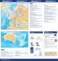
EUROPE 11P NORWAY NORTH WEST From Varangerfjorden to Bergen, including Nordfjord, Foerejorden, Dalsjorden. 12P NORWAY SOUTH WEST From Strandafjorden to Göteborg to Northern Denmark, including Skagerrak, Oslofjorden, Sognefjorden, Hardangerfjorden. 13P SWEDEN EAST From Aahus to Martinniemi, including Oeland, Gotland, Stockholm, Aland. 14P FINLAND From Karlsborg to Muhu, including Aland, Gulf of Finland, Hiiumaa, Helsinki, St. Petersburg, Tallinn. 15P OSLO TO DENMARK Denmark, Germany, Skagerrak, Sweden West. From Delfzijl to Skagen to Kolobrzeg, Flekkefjord to Oeland South, including Skagerrak,...
Open the catalog to page 2All Navionics catalogs and brochures
 Humminbird Models
2 Pages
 Northstar Models
2 Pages
 Raymarine Models
2 Pages
Archived catalogs
 Classic Charts Catalogue
2 Pages
 NavPlanner Catalogue
2 Pages
 Gold Catalogue
2 Pages
 Platinum+ Catalogue
2 Pages