

MASTER-DEQ 10/20

MASTER-DEQ 10/20
Catalog excerpts

ONBOARD DIVISION ELECTRONIC CHART DISPLAV AND INFORMATION SYSTEM - ECDIS > The first member of a family of onboard navigational systems > Fully complies the IMO requirements and IEC standard (IEC 61174) for ECDIS Electronic Charts and Databases used: provides their continuous - ARCS Raster Navigatici (British Admiralty) - BSB Raster Navigational Charts produced by different authorized organisations In USA and Canada - DEM - Digital Elevation Model - from USGS - Different proprietary charts and databases (e.g. topographical charts, navigational information and photos produced by MapTech) The Main features of the system: - flexible network architecture providing unlimited number of ¡ - possibility of translation of vessel's position via onboard TV | - route planning including voyage planning and route's E safety check : - route monitoring - true and relative motion - "North Up", "Head Up" and "Route Up" modes - ship's track recording with 10 seconds precision and electronic logbook - unlimited number of electronic rulers (ERBL) - a large set of different navigational alarms including ECDIS - tide calculation - trial manoeuvre - RADAR overlay - military maneuvering functions The system is mounted onboard in special certified hardware (console, computer, monitor...) mary number of electronic nautical charts of different formats distributed by NAUDEQ exceeds 5000
Open the catalog to page 1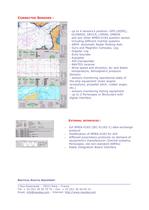
CONNECTED SENSORS : - up to 4 sensors’s position: GPS (DGPS), GLONASS, DECCA, LORAN, OMEGA and any other NMEA-0183 position sensor including different Inertial systems - ARPA Automatic Radar Plotting Aids - Gyro and Magnetic Compass, Log - Doppler Log - Echo Sounder - Autopilot - AIS transponder - NAVTEX receiver - Wind speed and direction, Air and Water temperature, Atmospheric pressure Sensors - sensors monitoring operational state of the ship equipment (main engine revolutions, propeller pitch, rudder angle, etc.) - sensors monitoring fishing equipment - up to 2 Periscopes or Binoculars with...
Open the catalog to page 2All NAUDEQ catalogs and brochures
 ARPA RADAR SIMULATOR
2 Pages
 VR-DYPO (DPS Simulator)
2 Pages
 COMMAND-DEQ
15 Pages
 LOAD-DEQ
3 Pages
 PRESSURES TRANSMITTERS
1 Page
 SONAR LEVEL GAUGING
1 Page


