
- Catalogs
- MaxSea International
- MapMedia Catalogue

MapMedia Catalogue

MapMedia Catalogue
MaxSea International, in collaboration with MapMedia, offers advanced marine cartography solutions. The document outlines the features and benefits of MapMedia's mm3d electronic charts, designed for MaxSea Time Zero and Furuno NavNet 3D systems.
Strengths & Features
MapMedia's mm3d charts include cartography, 3D data, and satellite images. The exclusive PhotoFusion technology integrates satellite images with marine charts. The catalogue offers a choice of chart formats: mm3d Raster, mm3d Vector C-Map by Jeppesen, and mm3d Vector Datacore by Navionics. Raster charts are derived from national hydrographic office charts, while vector charts comply with the S52 standard by the International Maritime Organization.
Chart Formats
MapMedia provides over 6000 electronic marine raster charts and a worldwide catalogue of vector charts in the mm3d format. Raster charts are digital reproductions of paper charts, while vector charts allow customization and are built from a vector database. Both formats have their advantages, with raster charts offering reliability and vector charts providing dynamic data management.
Technological Advancements
MapMedia developed a digitalization technology in 1994, enabling seamless chart display with automatic scaling. The mm3d format is designed for MaxSea Time Zero software and Furuno NavNet3D, offering immediate zooming and scrolling, PhotoFusion, and 3D visualization.
PhotoFusion Technology
PhotoFusion fuses satellite images onto charts, enhancing navigation by differentiating shallow waters and ocean bottom nature. Standard resolution satellite images are included in mm3d data packs, with high-resolution images available for select areas.
Conclusion
MapMedia's mm3d charts expand nautical cartography capabilities, offering a comprehensive global catalogue with options for raster or vector charts. The catalogue is available online, providing detailed information on chart areas and formats.
Catalog excerpts

Strengths & Features • MapMedia mm3d packs include cartography, 3D data and satellite images. • Exclusive PhotoFusion technology: mixing satellite images directly onto marine charts. • Worldwide online catalogue providing a choice of chart formats: Jeppesen mm3d Vector Datacore by Navionics • MapMedia mm3d Raster charts are produced from current national hydrographic office charts. • MapMedia mm3d Vector are produced in compliance with the S52 electronic chart visualization standard adopted by the International Maritime Organization (IMO). PUBLICISACTIV - RCB337934483 mm3d Raster mm3d Vector C-Map by Photos : Paul ROBIN / Document non contractuel - _072011-EN-MPM -BrochureMM3D • MapMedia’s mm3d electronic chart is especially designed for MaxSea Time Zero and Furuno NavNet 3D. MapMedia Catalogue MaxSea International - Technopole Izarbel -allée Théodore Monod - 64210 Bidart - France t/ +33 559 43 81 00 - f/ +33 559 43 81 01 - [email protected] www.maxsea.com MapMedia is a trade mark of the company MapMedia SAS. MaxSea is a trade mark of the company MaxSea International SAS. Navionics is a trade mark of the company Navionics SpA. C-Map is a trade mark of the company Jeppesen.
Open the catalog to page 1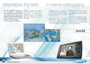
MapMedia, the best In 1994 MapMedia developed a new technology of digitalization and formatting geographical data that enabled nautical charts to be displayed seamlessly with automatic scaling. MapMedia chart formats have been on the forefront of technology for over 20 years. MapMedia charts are available in Raster and Vector chart formats. Our charts are produced in MapMedia’s new mm3d format, especially designed for MaxSea Time Zero software and Furuno NavNet3D. in marine cartography MapMedia offers a collection of over 6000 electronic marine raster charts produced directly from paper nautical...
Open the catalog to page 2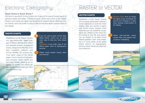
Electronic Cartography: Raster Charts or Vector Charts ? It’s hard to say which format is best; the choice of formats is mainly based on personal taste and habits. Traditional paper chart users tend to like Raster Charts, since these are digital reproductions of nautical charts. Whereas Vector Charts users will prefer to stick to this format that allows customization of the display. RASTER Charts MapMedia mm3d Raster Charts are geo-referenced, digital images of Official Hydrographic Office and selected private navigational charts, designed for MaxSea Time Zero navigation software and Furuno NavNet...
Open the catalog to page 3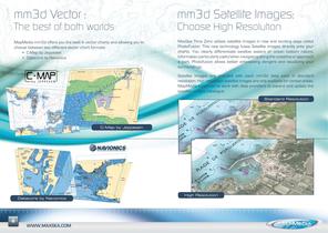
mm3d Vector : mm3d Satellite Images: MapMedia mm3d offers you the best in vector charts and allowing you to choose between two different vector chart formats: • C-Map by Jeppesen • Datacore by Navionics MaxSea Time Zero utilizes satellite images in new and exciting ways called PhotoFusion. This new technology fuses Satellite images directly onto your charts. You clearly differentiate swallow waters or ocean bottom nature, information particularly useful when navigating along the coastline or approach a port. Photofusion allows better anticipating dangers and visualizing your surroundings. The...
Open the catalog to page 4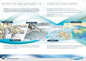
mm3d, the new generation of MapMedia’s new mm3d areas are specifically designed to utilize MaxSea’s new Time Zero technology. These charts allow optimal use of all versions of MaxSea Time Zero software and the Furuno NavNet 3D product line. Chart and Data format • Immediate zooming and scrolling of the chart without any lag. • PhotoFusion, the feature enable to fuses satellite images directly onto your chart, to simultaneously display the most relevant information from both satellite images and nautical charts • 3D visualization to increase situational awareness. Raster 2D view Raster 3D view...
Open the catalog to page 5
MapMedia Catalogue Wide & Mega Wide Two different area sizes available: Wide Area Sample R31MAP Iberia Mega Wide Area Sample MapMedia Online Catalogue available at www.maxsea.com WTRANSATMAP Trans Atlantic Find out more information on our web site : Datacore by 10 www.maxsea.com www.maxsea.com
Open the catalog to page 6All MaxSea International catalogs and brochures
 MaxSea Easy
2 Pages
 MaxSea TimeZero Catalogue
6 Pages

