
- Catalogs
- FLIR Systems, Inc.
- CORONA 350 II

- Products
- Catalogs
- News & Trends
- Exhibitions
CORONA 350 II

CORONA 350 II
Catalog excerpts
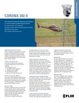
CORONA 350 II GYRO-STABILiZED POWER LiNE iNSPECTiON SYSTEM WiTH UP TO FOUR DiFFERENT CAMERA PAYLOAD OPTiONS Ultraviolet camera for corona detection Radiometric infrared camera for detecting thermal hot-spots High-definition video camera High-resolution digital frame camera SIMPLIFIED INSTALLATION The Corona 350 II is comprised of two units; the gyro-stabilized gimbal and the mission computer. The mission computer remotely controls the gimbal and cameras as well as recording and displaying of all mission data, video, and still images. “WALK-ON-WALK-OFF" The mission computer allows operators to quickly configure the aircraft for asset inspection. • No equipment rack • No ancillary video equipment • Additional seat available • No certification issues • More aircraft types can be used ASSET DATABASE IMPORT The system's asset database contains asset tables that can be tailored to meet different customer asset attribute lists, and is capable of holding in excess of 500,000 individual assets in ESRI Shape file format. BUILT-IN IMU The IMU is combined with the aircraft's GPS position and the mission system software's accurate global digital terrain elevation data model to calculate the EO/IR camera bore-sight and to lock the gimbal onto assets displayed on the moving map. The camera bore-sight is dynamically displayed relative to the aircraft position, deriving critical target information such as gimbal orientation, the geographic bore-sight position and elevation, and the position and identification of assets. DATA DISPLAY & COLLECTION Imagery captured by the mission computer includes video and high-resolution still images captured from the visible, thermal, and ultraviolet spectrums. Operators are provided with the tools necessary to view this imagery in real time to rapidly identify faults and defects in transmission assets, record critical mission and imagery data, and to save all data in the mission computer's hard disk drive for post-mission review and report generation. GROUND-BASED WORKSTATION The mission computer can also be used on the ground to load pre-flight map and asset data, and plan inspection missions. Post-mission, the mission analysis & review capabilities allow the user to specify start/ stop times, and review mission attributes such as aircraft position and track, camera bore-sight position and track, and all still imagery, video, vector overlays, and metadata captured during the mission. EASA CERTIFIED INSTALLATIONS FLIR Systems PolyTech AB is a certified Part 21 and Part 145 organization being able to issue release certificates of airworthiness (EASA Form 1) for its products for the most popular helicopter models currently operating worldwide. METADATA Aircraft navigation data, such as aircraft and bore-sight position, is appended to all captured imagery by way of the image metadata. All captured video clips and still images are time-stamped, and are synchronized with the associated geospatial mission data. To provide immediate operational context to the collected imagery, all video clips and still images are associated with the applicable asset. MOVING MAP The mission computer comes standard with a world 250k Delorme raster map and world-wide DTED. The software supports industry standard raster and vector map formats, and provides a standalone map converter application to enable the user to import custom map sets and elevation data.
Open the catalog to page 1
GIMBAL SPECIFICATIONS Active gyro-stabilization Field of Regard Maximum slew rate Maximum slew acceleration Diameter Height Weight (w/cameras and lens) 4 axis stabilization Elevation: +20° to -120° Azimuth: +360° continuous 60°/sec. >300°/sec/sec 13.8 in. (350 mm) 18.8 in. (478 mm) 59.5 lbs. (27 kg) ENVIRONMENTAL SPECIFICATIONS Standards RTCA DO-160E UV CORONA DETECTION CAMERA UV sensitivity Field of view Optical channels Focus Visible channel 3 x 10-18 watt/cm2 16°/8°/4° UV and visible channels overlaid Manual or automatic Synchronized with UV channel INFRARED CAMERA Detector Number of pixels...
Open the catalog to page 2All FLIR Systems, Inc. catalogs and brochures
 MARITIME SOLUTIONS
12 Pages
 FLIR M400
4 Pages
 FLIR M400 M500 LUXURY
20 Pages
 SeaFLIR 380-HD
2 Pages
 SEAFLIR 280HD
3 Pages
 FLIR SEAFLIR 230
2 Pages
 MSeries
2 Pages
 The FLIR AX8™
2 Pages

Archived catalogs
 MD-Series
2 Pages
 Maritime catalogue
24 Pages
 SeaFLIR ® II
2 Pages
 FLIR A65 / A35 / A15 / A5
2 Pages
 FLIR A6600/A6650
2 Pages
 Ocean Scout
2 Pages
 Automation Catalogue
12 Pages
 FLIR A6604
2 Pages
 FLIR G300pt
2 Pages
 FLIR G300 a
2 Pages
 FLIR FC-Series R
2 Pages
 FLIR A310 ex
2 Pages
 FLIR A310 pt
2 Pages
 FLIR A315 / A615
2 Pages
 FLIR A310
2 Pages
 FLIR A310 f
2 Pages
 FLIR GF-Series
9 Pages
 FLIR GF343
2 Pages
 2015 FLIR Maritime
28 Pages
 M-618CS
2 Pages
 flir seaflir 280 hd
3 Pages
 FLIR MV-Datasheet
3 Pages
 Land Systems
9 Pages
 FLIR Ranger MS-UC DefendIR
2 Pages
 VISUAL AUGMENTATION SYSTEMS
8 Pages
 BORDER + COASTAL SURVEILLANCE
16 Pages
 BLACK HORNET
12 Pages
 BHM-Series Datasheet
2 Pages
 FLIR BHM-SERIES
2 Pages
 First Mate II
4 Pages
 seaflir ® 280-hd
3 Pages
 SEAFLIR 280-HD
3 Pages
 Black Hornet PRS
2 Pages
 Black Hornet VRS
2 Pages
 FLIR Agentase C2 TM
2 Pages
 FLIR FIDO X2 ®
2 Pages
 FLIR FIDO X3 ®
2 Pages
 FLIR ARGUS™
2 Pages
 FLIR Cerberus™
2 Pages
 FLIRIBAC™ OEM Kit
2 Pages
 FLIR IBAC 2™
2 Pages
 FLIR LTV-X™
2 Pages
 FLIRLVSS
5 Pages
 FLIR MVSS
2 Pages
 Recon® M18 SWIR
2 Pages
 Recon® M18
2 Pages
 FLIR MARITIME SOLUTIONS
9 Pages


- FLIR professional video camera
- CCTV video camera
- FLIR ship video camera
- FLIR fixed video camera
- FLIR night vision video camera
- FLIR compact video camera
- FLIR video camera with zoom
- FLIR thermal video camera
- Monitoring system
- FLIR color video camera
- Boat video camera
- IP67 video camera
- Infrared video camera
- Ship monitoring system
- Rugged video camera
- Waterproof video camera
- FLIR low-light video camera
- Digital video camera
- Multifunction monitoring system
- Alarm monitoring system