Catalog excerpts

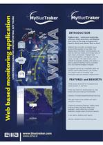
MyBlueTraker - web based monitoring software which processes and displays your data on the map and generates reports about your leisure fleet or boat. MyBlueTraker provides immediate visual access to the position of your fleet. The display shows the fleets' current position, as well as a 30-hour history and 15-day track of each ship's movements. MyBlueTraker automatically gathers and displays the ship name, call sign, UTC date & time, exact latitude a longitude, heading, and speed in a basic graphical interface that is accessible from any Internet enabled computer. It supports service as e-mail/SMS alerts for sensors and Private Distress Call, Position Poll, Report Interval Changing, High Resolution Data and distance measurement. •Web access to the server to pinpoint your vessel position in real time. •View your boat (or vessel group) on map charts with zoom and pan functionality •Display of location/speed/heading/route logs •Set geo-zones to be notified with alarm (Premium version) •Optional monitoring features: battery level, engine oil level, fuel level, bilge pump indication, motor RPM, fire or smoke detectors, burglar alarm (Premium version) •View alerts, statistics and reports •Review detailed historical tracking data
Open the catalog to page 1All EMA d.o.o. catalogs and brochures
-
bluetraker ssas Arctic
2 Pages
-
Iridium ssas
2 Pages
-
BlueTraker SSAS
2 Pages
-
CAN DIO
4 Pages
-
BlueTraker VMS
8 Pages
-
Connectivity Display
2 Pages
-
BlueTraker VMS data sheet
4 Pages
-
Fit The Fleet
2 Pages
-
Bluetraker Exploded View
1 Pages
-
BlueTraker® VMS Light
6 Pages
-
BlueAIS®
6 Pages


