

MC 600CI

MC 600CI
This document serves as the owner's manual for the CobraMarine MC 600Ci and MC 600Cx chartplotters, detailing their operation, features, and customer support options.
The CobraMarine chartplotter is a navigation tool that integrates GPS with electronic chart displays, utilizing C-MAP C-CARDs for enhanced cartographic information.
Users are encouraged to consult the manual for troubleshooting, with additional support available through Cobra Electronics' customer services.
The chartplotter includes a base map, 3D mapping, and a 12-channel WAAS GPS with iASAP technology, supporting various modes and features like DSC calling integration and tide information display.
The device operates on 10-35 V power, features a 6-inch color TFT display, and is submersible to IPX7 standards, supporting NMEA-0183 interfaces.
Electronic charts should not replace official nautical charts. Precautions against heat, reversed polarity, and UV exposure are advised.
Proper cleaning using isopropanol-based cleaners is crucial to maintain the screen's anti-reflective coating.
The package includes the chartplotter, power data cable, mounting bracket, faceplates, owner's manual, and additional components for the MC 600Cx model.
The manual guides users through sections on introduction, customer assistance, control and indicators, software features, technical specifications, warnings, and basic operation procedures.
Instructions for powering on the device, setting initial configurations, and adjusting display settings are provided, along with page surfing and demo modes for user familiarization.
Detailed descriptions and instructions for various pages, including the Welcome Page, Chart Only Page, and others, are included, with customization options for layouts and data fields.
This section covers advanced functionalities like waypoint operations, route creation, and track management, along with user point management and User C-CARD operations.
Button conventions, menu descriptions, and option selection processes are outlined for ease of use.
Instructions for switching the device on/off, initial setup, and adjusting backlighting and contrast are provided.
Customization options for display, chart, fish finder, alarm, and GPS settings are detailed.
Basic and advanced installation instructions, including GPS antenna mounting, are provided.
System test procedures and maintenance tips are included to ensure functionality.
Information on optional accessories like PC-Planner and MF 2500 Fish Finder is provided.
Includes terms and GPS information, along with world city time zones.
Users can adjust light levels and toggle color palettes for better visibility under different lighting conditions.
The device offers multiple pages of data navigable via the PAGE button or CURSOR buttons, with customizable page settings.
Demo Mode allows practice without satellite signals, offering various interaction levels.
Users can pan and zoom on the chart for navigation and detail adjustment.
Data fields can be customized through the MAIN Menu, allowing selection and modification of displayed data.
Users can create Waypoints and Marks on the chart for navigation and location marking.
Routes are created by placing Waypoints on the chart, with editing options available.
The GOTO function allows quick course plotting, while the Find function searches for points of interest or coordinates.
The MOB function marks a location for emergencies, requiring a valid GPS fix.
Pages can be customized and shortcuts assigned for quick access.
The main navigation page displays maps, vessel position, and navigational data, with customizable data fields.
Allows customization of data fields with various layout options and menu operations for optimal performance.
Provides steering guidance with customizable data fields and perspective adjustments.
Displays tide station information and allows date changes for tide charts.
Provides sonar images and information about fish and bottom structures, with various customization options.
Instructions on using a Fish Finder device, focusing on features and settings for optimal detection.
Instructions for deleting, moving, inserting, and editing waypoints are provided.
Details on selecting, naming, and managing routes are included.
Track storage and display settings are outlined, with options for activation and visibility.
Instructions for managing user points are provided.
Details on managing data with a User C-CARD, including formatting and file management, are included.
Automatic information display and tidal current predictions are explained.
Animated navigation aids and associated images are described for better identification.
DSC features for VHF radio calls and contact management are outlined.
Customization options for display settings are detailed.
Various display modes and backlighting options are provided for optimal visibility.
Customization options for cartographic information display are detailed.
Options for controlling depth information display are provided.
Management of terrestrial feature display is outlined.
Further customization options for chart features are provided.
Basic setup configurations are outlined.
Display and sensitivity settings for Fish Finder devices are detailed.
Frequency selection, gain control, and other settings for optimal detection are provided.
Instructions for adjusting depth measurement and calibration are included.
Various alarms for navigation and fish detection are outlined.
Options for selecting units of measurement are provided.
Options for GPS configuration and correction are detailed.
Simulated navigation data for training purposes is explained.
Configuration options for communication ports are provided.
Instructions for chartplotter and GPS antenna installation are included.
Detailed instructions for GPS antenna mounting and maintenance are provided.
Steps for flush mounting the antenna are outlined.
Routine maintenance tips and system test procedures are included.
Descriptions of optional accessories like PC-PLANNER and MF 2500 Fish Finder are provided.
A glossary of navigation and GPS terms is included for better understanding.
Technical terms and features related to navigation systems are outlined.
Details on GPS functionality and accuracy are provided.
A table of world city time zones is included.
A glossary of navigation-related terms is provided.
Details on chart and display settings are included.
Various alarms for safe navigation are outlined.
Instructions for antenna mounting and system setup are provided.
Catalog excerpts

MARINE CHART PLOTTER Nothing Comes Close To A Cobra"
Open the catalog to page 1
Our Thanks to You and Customer Assistance Thank you for purchasing a CobraMarineTM MC 600Ci or MC 600Cx chartplotter. Properly used, this product will give you many years of reliable service. www.cobra.com How Your Cobra® Chartplotter Works The CobraMarineTM chartplotter is a state-of-the-art computerized electronic chart system, designed as a sophisticated navigation aid. User friendly operations make the chartplotter easy to operate. All calculations and information necessary for the navigation are performed and displayed on the screen quickly and accurately providing all of the capabilities...
Open the catalog to page 2
Our Thanks to You and Customer Assistance Thank you for purchasing a CobraMarineTM MC 600Ci or MC 600Cx chartplotter. Properly used, this product will give you many years of reliable service. www.cobra.com How Your Cobra® Chartplotter Works The CobraMarineTM chartplotter is a state-of-the-art computerized electronic chart system, designed as a sophisticated navigation aid. User friendly operations make the chartplotter easy to operate. All calculations and information necessary for the navigation are performed and displayed on the screen quickly and accurately providing all of the capabilities...
Open the catalog to page 3
Software Features and Technical Specifications Control and Indicators SOFTWARE FEATURES Detailed Base Map Included 3D Mapping (view charts in either top down or new 3D perspective modes) 12 Channel WAAS GPS with iASAPTM Sunlight and NightWatchTM Modes Easy surfing among the available pages (Data, Highway, Sun & Moon, Split, GPS Status, System and Welcome pages) Fish Finder and Combo pages (available with Fish Finder device connected) DSC Calling integration 1000 Waypoints and 50 Routes (50 Waypoints/Route) Create, Move, Insert, Edit or Erase Waypoint Create, Save, Name, Edit or Follow a Route...
Open the catalog to page 4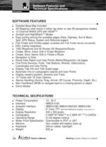
Software Features and Technical Specifications Control and Indicators SOFTWARE FEATURES Detailed Base Map Included 3D Mapping (view charts in either top down or new 3D perspective modes) 12 Channel WAAS GPS with iASAPTM Sunlight and NightWatchTM Modes Easy surfing among the available pages (Data, Highway, Sun & Moon, Split, GPS Status, System and Welcome pages) Fish Finder and Combo pages (available with Fish Finder device connected) DSC Calling integration 1000 Waypoints and 50 Routes (50 Waypoints/Route) Create, Move, Insert, Edit or Erase Waypoint Create, Save, Name, Edit or Follow a Route...
Open the catalog to page 5
Warnings and Cautions WARNINGS AND CAUTIONS Before using your CobraMarineTM MC 600C chartplotter please read these general precautions and warnings. Electronic charts displayed by the chartplotter are believed to be accurate and reliable, but they are not intended to replace official charts which should remain your main reference for all the matters related to the execution of a safe navigation. For this reason we would like to remind you that you are required to carry on board and use the officially published and approved nautical charts. Please read through this manual before the first operation....
Open the catalog to page 6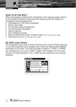
Included in This Package and C-MAP C-CARD WHAT IS IN THE BOX? When the package containing the chartplotter is first opened, please check it for the following contents (if any parts are missing contact the dealer the chartplotter was purchased from): CobraMarineTM MC 600C chartplotter Power Data Cable Tilt and Swivel Mounting Bracket Two Removable Faceplates Owner’s Manual Quick Reference Guide External GPS Antenna with 10 Meter Cable (ONLY on MC 600Cx model) Flush Mount Kit (ONLY on MC 600Cx with model) MC 600C Chart Details The chartplotter has a built-in world map that can be used for Route...
Open the catalog to page 7
General Operation 1.2. GENERAL OPERATION 1.2.1. Button Conventions Used Throughout this Owner’s Manual, the hardware buttons on the MC 600C are shown in bold capital letters, for example ENTER; the software buttons are shown in bold small capital letters, for example EDIT. See the following pictures. Any menu operation and function activation in this Owner’s Manual is related to both MC 600Cx and MC 600Ci chartplotter models. Whenever it is necessary, a note has been inserted for the model with differences. 1.2.2. Menu Description Many of the options listed under the Page Information and Operation...
Open the catalog to page 12
Chart page Main Menu CURRENT PREDICTIONS USER C-CARD ADVANCED CHART SETUP DATA FIELDS CHANGE DATA FIELDS NUMBER OF DATA FIELDS 2 ADVANCED DATA SETUP Number of data Fields option CURRENT PREDICTIONS USER POINT LIST ADVANCED CHART SETUP £!v DATA FIELD \ CHANGE DATA FIELDS f STEERING COMPASS NUMBER OF DATA FIELDS 2 ADVANCED DATA SETUP
Open the catalog to page 13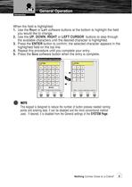
General Operation When the field is highlighted: 1. Use the RIGHT or LEFT software buttons at the bottom to highlight the field you would like to change. 2. Use the UP, DOWN, RIGHT or LEFT CURSOR buttons to step through the available characters until the desired character is highlighted. 3. Press the ENTER button to confirm; the selected character appears in the highlighted field on the top line. 4. Repeat this procedure until you complete your entry. 5. Press the SAVE software button when the entry is complete. This keypad is designed to reduce the number of button presses needed naming points...
Open the catalog to page 14
Switching On/Off 2. BASIC OPERATION Refer to the foldout on the front cover to identify the various controls and indicators on your chartplotter. 2.1. SWITCHING ON/OFF Before powering On the chartplotter, check for the correct voltage (10-35 volt dc). 2.1.1 Switching On Press and hold the PWR button for one (1) second. The chartplotter shows you the Logo Screen, Caution Notice (press the ENTER button) and then the WELCOME Page in sequence. See the INITIAL SETUP Page instruction for first time switch On instructions. 2.1.2 Switching Off Press and hold the PWR button for three (3) seconds. A countdown...
Open the catalog to page 15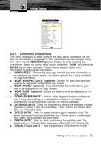
Initial Setup 2.2.1. Definitions of Selections This menu allows you to select some of the basic setup information the first time the chartplotter is powered On. This information can be changed at any time either from the SYSTEM Page (see Chapter 5) or by resetting the chartplotter. Select the correct setup option and select “DONE” and press the ENTER button when complete. Please refer to section 1.2 for more information on how to enter information. “LANGUAGES” - Selects the language in which you wish information to be displayed (for screen labels, menus and options, but it does not affect the...
Open the catalog to page 16All Cobra catalogs and brochures
 DASH 2316D
2 Pages
 29 LX BT
2 Pages
 29 LX MAX
2 Pages
 CPP 9000
2 Pages
 CPI 2590
2 Pages
 CPI 1590
2 Pages
 CPI 1090
2 Pages
 CPI 890
2 Pages
 CPI 490
2 Pages
 MR F45-D
2 Pages
 Cobra-AdventureHD-5200
2 Pages
 Cobra Adventure HD 5210
2 Pages
 WASPcam_9905Wi-Fi
2 Pages
 WASPcam 9906CAMO
2 Pages
 WASPcam 99074K
2 Pages
 CDR 835
2 Pages
 CDR 855 BT
2 Pages
 CDR875G
2 Pages
 CDR 895 D
2 Pages
 C 75 WX ST
2 Pages
 19 DX IV
2 Pages
 18 WX ST II
2 Pages
 29 LTD CHR
2 Pages
 25 LTD
2 Pages
 29 NW
29 NW2 Pages
 25 NW
25 NW2 Pages
 29 LTD
2 Pages
 RAD 350
2 Pages
 MR F55-D
2 Pages
 MR F77B GPS
2 Pages
 MR HH450 DUAL
2 Pages
 MR HH350W FLT
2 Pages
 MR HH350 FLT
2 Pages
 MR F55B-D
2 Pages
 MR HH125
2 Pages
 MR F77W GPS
2 Pages
 MR HH450 CAMO
2 Pages
 MR F57B
2 Pages
 MR HH425LI VP
42 Pages
 MR HH325 VP
35 Pages
Archived catalogs
 MR F75 manual
40 Pages
 MR F80 manual
83 Pages