Catalog excerpts

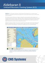
Onboard Electronic Charting System (ECS) Aldebaran II is CNS Systems' Electronic Charting System (ECS) software for use onboard vessels. Aldebaran II is designed with advanced navigation and communication features and is used by profes- sionals worldwide. ECS Solutions improve efficiency and safety in today's fast paced computer-aided navigation and situational awareness environments. Aldebaran II offers complete AIS (Automatic Identification System) integration with the ability to display static, dynamic, and voyage related information in real-time on a multitude of electronic chart formats. As well, the ECS has the ability to send safety related text mes- sages to other aircraft, vessels and shore-based administrators. Aldebaran II supports multiple chart formats simultaneously and includes real-time data logging and playback, administrative options, long range interface, support of TCP/IP communications, manua chart connections, route verification, critical points, multiple guard zones and SAR drift offset. Aldebaran - [Info (1:30,000) 11324 557 1:25,000 DU=METRES Base Display North Up] Chart 3D Survey Route Nav Aids SAR Nav Elements Tow Boat AIS Light Level Voyage Event! DR! Man Overboard! View Window Help S57 I S57? I S57 Lists Survey NavAids Buoy Tending 3D Nav I Route | GPS AIS Irlo | AIS 7 | AIS Tx | AIS RK | All Target: Remote Hame MMSI Number Call Sign European Ship Number Hazardous Cargo Positional Accuracy Time Since Last Update Blue Sign MARTIN EXPRESS MARTIN EXPRESS MARTIN EXPRESS OTTO CANDIES SUSAN NAH_G... Silence ■ UTC 13:52:53 Chart List Created CNS Systems' Electronic Charting System (ECS), Aldebaran II, is highly configurable to meet your needs while maintaining the consistent, powerful, professional utility you
Open the catalog to page 1
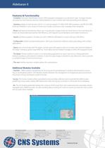
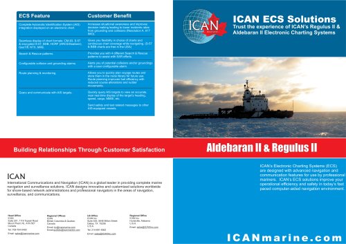
Features & Functionality - Complete Automatic Identification System (AIS) integration displayed on an electronic chart. Increases situatio- nal awareness and improves decision making leading to lower incident rates from grounding and collisions. - Seamless display of chart formats: CM-93, S-57 and encrypted S-57, BSB, HCRF (ARCS/Seafarer), GeoTiff NTX, MRE. Gives you flexibility in your choice of charts and includes continuous chart coverage while navigating. - Route planning and monitoring. Allows you to quickly plan voyage routes and store them in the route library for future use. Route...
Open the catalog to page 2All CNS Systems AB catalogs and brochures
-
Special Water Innovation 2019
53 Pages
-
Ground Station - Advanced
2 Pages
-
VDL 4000/GSI
2 Pages
-
Aldebaran III
2 Pages
-
DataSwitch
2 Pages
-
Pegasus
2 Pages
-
VDL 6000/FASS Advanced
2 Pages
-
VDL 6000/FASS
2 Pages
-
Sentinel
2 Pages
-
VDL 6000 AIS Class A
2 Pages
-
Maestro
2 Pages
-
DataStore
2 Pages
-
Horizon
2 Pages
-
VDL 6000 AIS Airborne System
2 Pages
-
VDL 6000 AIS Secure System
2 Pages
-
VDL 6000 AIS Inland
2 Pages
-
Electronic Charting System
2 Pages
-
VDL 6000 AIS Class A System
2 Pages


